Catalog Archive
Auction 133, Lot 428

"[Lot of 2] Kaart van't Graafschap Henegouwen [and] Comitatus Flandriae Accurata Descritio La Comte de Flandre",

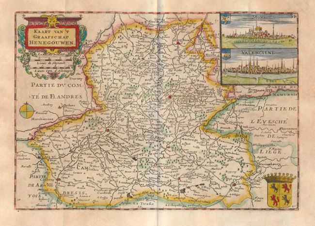
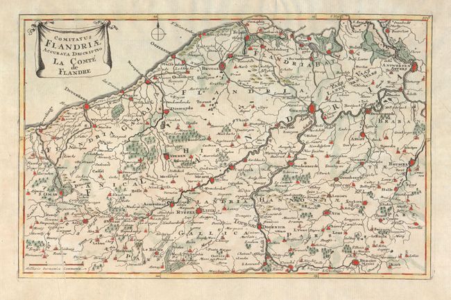
Subject: Low Countries

Period: 1735-50

Publication:

Color: Hand Color

Size:
See Description
Download High Resolution Image
(or just click on image to launch the Zoom viewer)

1)Kaart van't Graafschap Henegouwen, by Daniel de la Feuille, from Kleyne en Beknopte Atlas, of Tooneel des Oorlogs in Europa, circa 1735 (8.5 x 5.8"). An attractive small map with insets of Mons and Valencienne. The map covers the region along the current border with France and Belgium.

2)Comitatus Flandriae Accurata Descritio La Comte de Flandre, anonymous, circa 1750 (11.2 x 7.0") A nice map of Belgium with a good amount of detail.

References:

Condition: B+

Both with some toning and minor tears in the blank margins.

Estimate: $100 - $140

Sold for: $60

Closed on 9/1/2010

Archived