Catalog Archive
Auction 133, Lot 330
"A New and Accurate Map of the Island of Antigua or Antego … Containing all the Towns, Parish Churches, Forts, Castles, Windmills, Roads &c.", Bowen, Emanuel
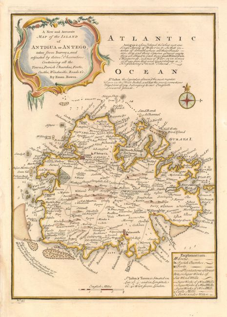
Subject: Antigua
Period: 1747 (published)
Publication:
Color: Hand Color
Size:
9 x 12.5 inches
22.9 x 31.8 cm
Download High Resolution Image
(or just click on image to launch the Zoom viewer)
(or just click on image to launch the Zoom viewer)