Subject: Santa Cruz, California
Period: 1854 (dated)
Publication:
Color: Black & White
Size:
12.6 x 12.2 inches
32 x 31 cm
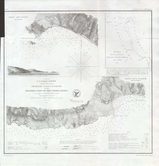
This terrific chart is from the first official scientific reconnaissance of the Pacific coast. The main portion of the chart shows Santa Cruz Harbor and Vicinity. Details include the town and mission with fully engraved topography inland. In the harbor scores of soundings are given along with tables on tides and other information. Locates Point Santa Cruz. Above this map is another on the same scale "Point Ano Nuevo Anchorage" which continues the Santa Cruz map. At upper right the inset "Sub-Sketch Showing the positions of Santa Cruz & Ano Nuevo Harbors" continues north to San Francisco Bay. By James Arden Lieut. USN with Topography by A.M. Harrison. Engraved by A. Maedel, J. Young & C.A. Knight. The map is embellished with a magnetic rose and the seal of the Coast Survey Office.
References:
Condition: A
Fine, bright example that is flawless except for a 1/2" binding trim tear, well closed on verso.