Subject: Alaska
Period: 1906-1915 (dated)
Publication:
Color: Printed Color
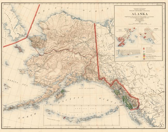
Alaska Compiled from the Official Records of the General Land Office U. S. Coast and Geodetic Survey, 1906, General Land Office, 37.4" x 29". This first edition is a huge and very handsome map of the territory filled with a remarkable amount of information and details. Large insets of the Aleutian Islands, plus town plans of Sitka, Juneau and Nome. Legend locates cities, towns and settlements, National Forests, Military Reserves including Naval and light houses, Indian Reservations, and Reindeer Station Reserves. No sign of Anchorage in the area, but Ladds Station, Hope, and Knik Station are located. Made under the direction of Frank Bond, Chief of Drafting. Lithography by Andrew B. Graham Co., Washington, D.C. Blank verso. A very graphic and striking map. Near fine example with strong, bright color and full margins. A hint of offsetting in blank areas of title block. Folding as issued. (A)
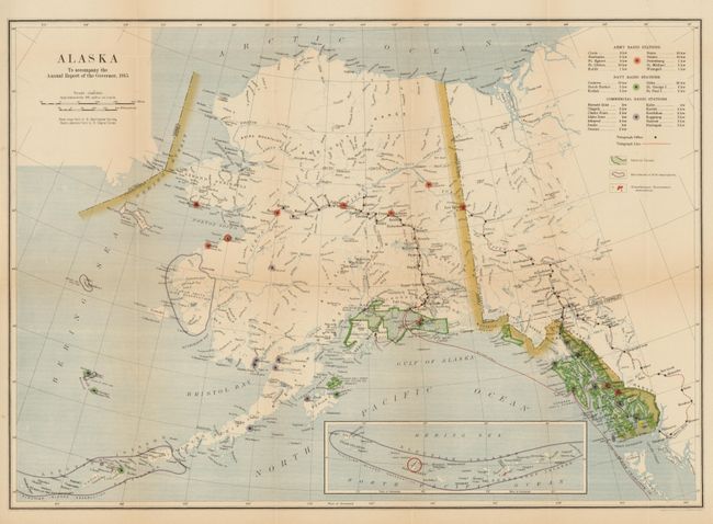
Alaska To Accompany the Annual Report of the Governor, 1915, USGS, 23.8" x 16.8". This map, based on the map from the U. S. Geological Survey, is very handsome with crisp engraved lines and very nice color. It details early radio stations, locating those of the Army and Navy, plus all commercial radio stations and telegraph lines. A table names the stations and lists their transmitting power. An inset map of the Aleutian Islands shows the entire chain to be within the boundary of a bird reservation. Folding as issued with strong color and full margins. Very light area of toning along one horizontal fold line. (B+)
References:
Condition:
See individual descriptions.