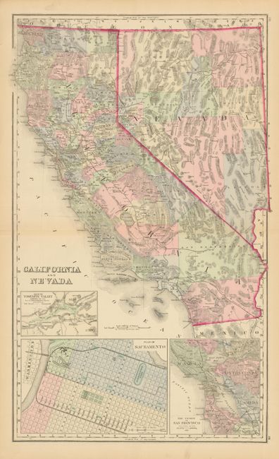
Subject: California and Nevada
Period: 1872-74 (published)
Publication:
Color: Hand Color
California and Nevada, by F.A. Gray, from The National Atlas, ca. 1874, (16 x 26"). This is a beautifully colored and engraved double-page map showing numerous named railroads, cities and towns, watershed, forts, and more. Three large insets: Plan of Sacramento; The Vicinity of San Francisco; and Map of the Yosemite Valley. Early railroads are detailed. In this version the rail line from Los Angeles extends about 40 miles north of Redding and east into San Bernardino County to Camp Cady. The Central Pacific Railway crosses Nevada to Sacramento; several spurs radiate from the San Francisco Bay area. County development is accurate to 1874 except the border between San Bernardino and Inyo counties is incorrectly shown pre-1872. On verso are two full-page maps: a fine street plan of San Francisco, and Oregon and Washington. A large and handsomely colored map of California. (A)
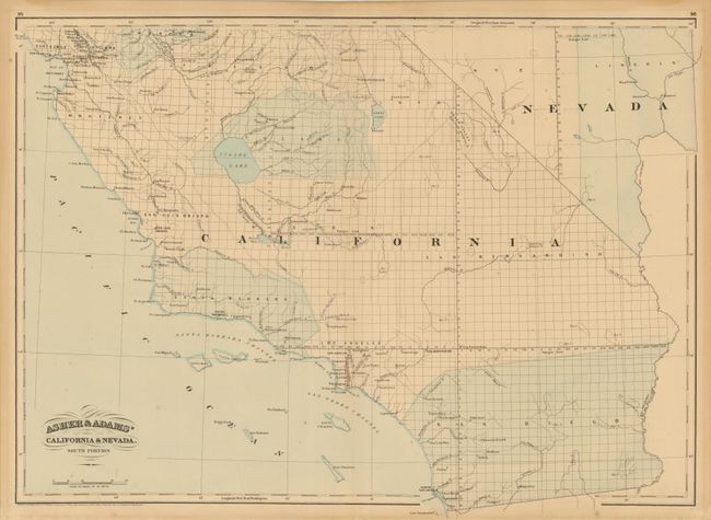
Asher & Adams' California & Nevada. South Portion, Asher & Adams, 1872, (22.8 x 16.3"). This map details the cities and towns, watershed, political divisions and townships, but does not show any railroads or roads. Light wash color. Blank verso.
References:
Condition: A
Both are very good with no major flaws.