Subject: Mid-Atlantic
Period: 1829 (circa)
Publication: House Doc. 38, 20th Cong., 2nd Sess.
Color: Black & White
Size:
16.5 x 36 inches
41.9 x 91.4 cm
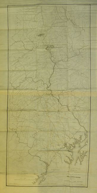
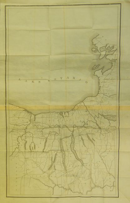
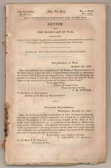
A pair of early maps that reflect the federal government's early concern for providing a viable transportation system across the country. The detailed and interesting maps were based on a map by Col. Stephen H. Long, compiled by F. Harrison, Jr., drawn by A.J. Stansbury, and engraved on copper by W. Harrison. The first sheet covers an 80-mile section from just below Washington D.C. to Athens, PA, on a scale of five miles to the inch. The various routes run through Harrisburg, Williamsport, Baltimore and Lancaster. Sized as given at left. The second map is untitled and shows the road system north of the Susquehanna River to Lake Ontario. Both are filled with great detail of country roads, turnpikes, towns and even locate taverns, stores, and more. Also, each is printed on two joined sheets. Size given is for the first map, the second untitled map measures 17 x 28.5". A very historical lot which are bound in the original report Road - Washington to Northwest Part of New York (6" x 9") which contains the 22pp report of Wm. Howard, U.S. Civil Engineer. Sent from C. Gratiot, Co. Engineers to P.B. Porter, Secretary of War and to A. Stevenson, Speaker of the House.
References:
Condition: B+
Both with a little light offsetting and toned at paper join, otherwise they are flawless, uncommon for folding maps from this period. Both are on fine banknote style paper. The pages of the disbound report are foxed.