Subject: Atlases
Period: 1564 (dated)
Publication:
Color: Black & White
Size:
11.5 x 8 inches
29.2 x 20.3 cm
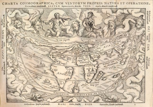
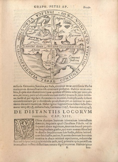
Included in this complete Latin edition of Apianus' popular Cosmographia is a very interesting world map based on the now lost world map of Gemma Frisius, which is significant in the history of the mapping of America. The continents are broadly based on Mercator's globe gores of 1541, but North America is shown as a long slender landmass labeled Baccalearium in reference to the cod fishing region off the coasts of New England and Canada. It employs a cordiform projection and depicts a distinct northern passage to Asia over the top of North America. There are few geographical features other than the prominent twin lake sources of the Nile in Africa. The heart-shaped border of the map contains signs of the zodiac within a cloud background filled with mythical figures and wind heads. One of the deities at top sports the design of the Holy Roman Emperor's double eagle on his breastplate and the three cadaverous wind heads at bottom represent plague-carrying winds of the south. This is an example from the second of three woodblocks, issued with Latin and Dutch text.
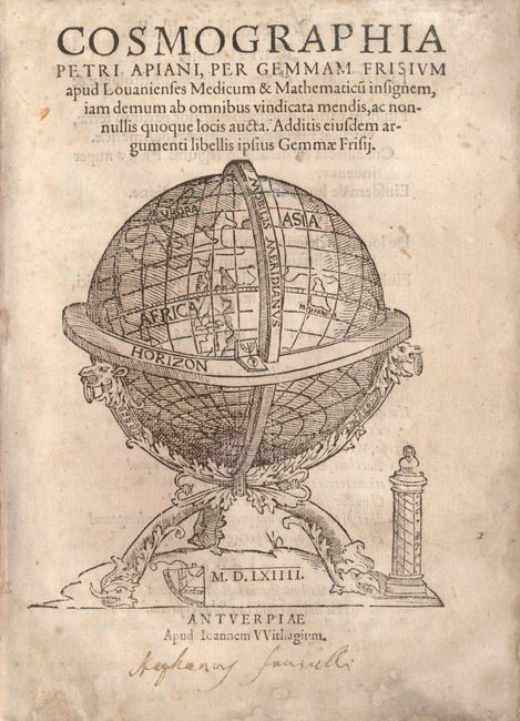
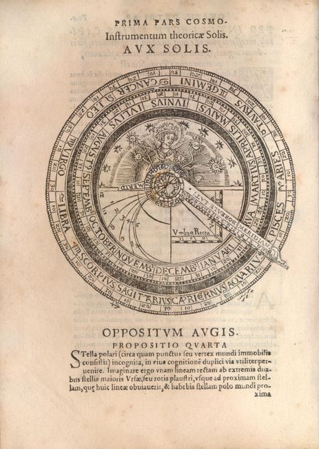
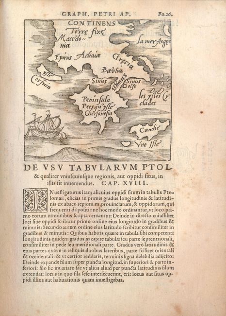
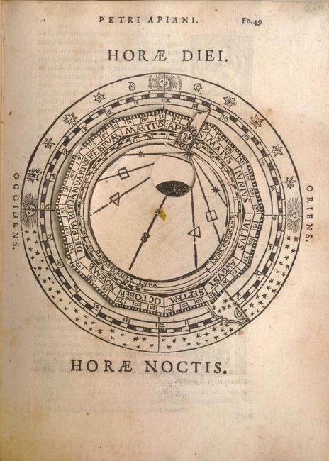
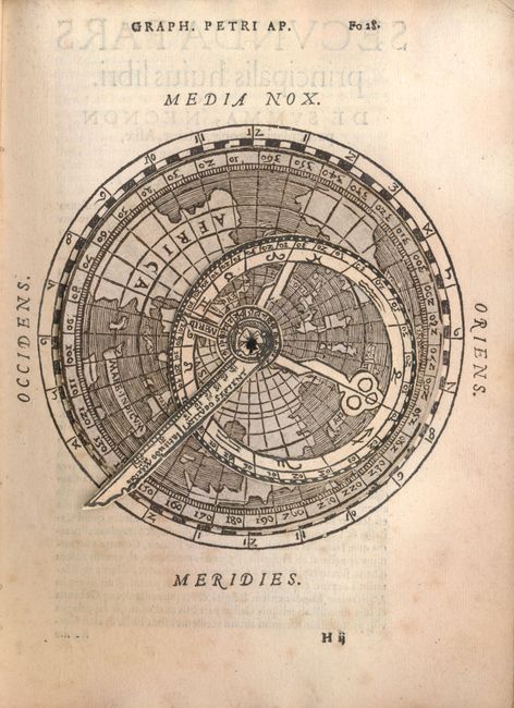
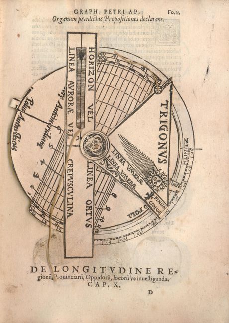
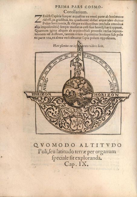
The Cosmographia of Petrus Apianus was one of the most popular books on cosmography ever published. It covers a multitude of subjects including the climatic zones, the uses of parallels and meridians, the determination of latitude and longitude, map projections, etc. One of the reasons it was enormously popular is the inclusion of volvelles that enabled one to solve practical mathematical problems relating to time telling, the calendar, astronomy and astrology. There are five of these ingenious paper devices included, and numerous other interesting diagrams and illustrations. In addition to the world map, there is also a small map of Greece, and one of the volvelles is constructed on a map of the northern hemisphere. This edition, corrected and augmented by geographer and mathematician Gemma Frisius, contains Gemma's important treatise on triangulation, which first appeared in 1533. The treatise was the first instance of triangulation being proposed as a means of locating and mapping places. Small 4to, bound in original limp vellum covers.
References: Shirley #96.
Condition: B+
Covers stained with moderate wear and a split fore-edge. Endpapers stained, contents with some toning and light foxing. All volvelles are fully functional. Map with faint foxing, else very good. There is a contemporary brown ink signature on the title page and some notations on the verso of the last index leaf.