Catalog Archive
Auction 132, Lot 568

"Carte de l'Empire Othoman Consideree dans les Etats de Cette Puissance, et des Etats qui l'Avoisinent ou qui luy sont Tributaires, Ainsi que Deux Petites Cartes pour Conduire, a l'Histoire Universel et en Particulier a l'Histoire d'Alexandre le Grand", Chatelain, Henry Abraham

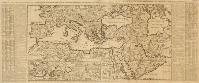
Subject: Mediterranean and Middle East

Period: 1720 (circa)

Publication: Atlas Historique

Color: Black & White

Size:
35.5 x 19 inches
90.2 x 48.3 cm
Download High Resolution Image
(or just click on image to launch the Zoom viewer)

This grand map shows the extent of the Ottoman Empire with comparisons to the Empires of Alexander the Great and the Romans. It covers the Mediterranean, southern Europe and northern Africa and extends to the Caspian Sea, Persia, and the Arabian peninsula. Below are two insets, one of an area similar to the large map and the other of the Peloponnesian Peninsula (Greece). At sides, tables describe the countries and towns depicted on the maps, together with historical notes on the Empire of Alexander the Great and the Roman Empire. Two sheets joined, as issued.

References:

Condition: B

Sharp impression with some uneven toning and old repaired tears along a couple of folds.

Estimate: $550 - $650

Sold for: $550

Closed on 6/2/2010

Archived