Subject: St. Petersburg, Russia
Period: 1765 (circa)
Publication:
Color: Hand Color
Size:
23.2 x 18.8 inches
58.9 x 47.8 cm
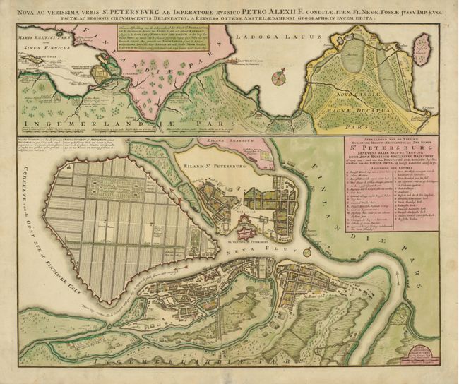
This great map of St. Petersburg illustrates the plans of Peter the Great to build an entirely new capital city for his Russian Empire. The plan shows the growing city that surrounds the Peter and Paul Cathedral and fortress on the Island of St. Petersburg (Zayachy Island), and around the shipyards on Admiralty (Admiraliteits) Island. Vasilievsky Island is depicted with a rectangular grid of canals, a palace and two elaborate formal gardens. These plans were developed by architect Domenico Trezzini between 1716 and the early 1720s. The project was never completed, but is still evident in the layout of the streets in the modern city. Above the plan is a map showing the city's geographical context between the Gulf of Finland and Lake Ladoga. It shows the historic Ladoga Canal, also a project of Peter the Great. This map was drawn by Reiner Ottens and published by the widow of Joshua Ottens.
References:
Condition: B+
Original color and a good impression. There are some repaired tears in the blank margins and the centerfold has been reinforced.