Subject: England
Period: 1700 (circa)
Publication:
Color: Hand Color
Size:
20 x 16.2 inches
50.8 x 41.1 cm
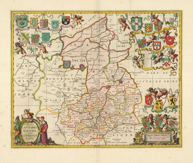
This exquisite county map of Cambridgeshire is typical of Dutch mapmaking in its highest form with fine engraving, composition and profuse decorative elements. It also presents a clear picture of the countryside with rivers, forests, parks, towns and villages, and the county divisions. The title cartouche is flanked by scholars and the other corners are filled with the armorials of the nobility and the insignia of the colleges along with the dates of their founding.
References:
Condition: A+
Fine crisp impression with superb original color. There are a couple tiny spots in the wide original margins, still overall fine condition.