Subject: St. Lucia
Period: 1726 (published)
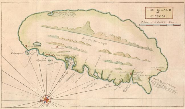
Publication: A history of the voyages and travels of Capt. Nathaniel Uring
Color: Hand Color
Size:
16.3 x 9.3 inches
41.4 x 23.6 cm
This is the earliest map to focus solely on St. Lucia. One of the Windward Islands, it was first colonized by the French in the mid seventeenth century. Shortly thereafter, it was taken by Britain and then alternated between French and British control numerous times for the next 150 years. In 1722, the island was granted by the King of England to the Duke of Montague, who fitted out an expedition led by Capt. Nathaniel Uring. Uring briefly set up a settlement at Petit Carenage, but met with strong local French opposition and had to withdraw from the island. This map shows the French and native settlements along with harbors, soundings and hazards on the west side of the island. A compass rose orients the map with north to the left.
References:
Condition: A
Issued folded, now flattened with the binding trim at lower left extended to accommodate framing. There is a repaired fold separation in the top margin, not affecting the map.