Subject: Greater Antilles
Period: 1690-1815 (published)
Publication:
Color: Hand Color
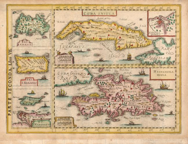
1) Cuba Insula / Hispaniola Insula … by Johannes Cloppenburg, [1690] (10 x 7.4"). Decorative map of the West Indies showing Cuba with a small inset of Havana, Hispaniola, Jamaica, Puerto Rico and Margarita. This engraving is from Gregorio Leti'sTeatro Belgico, o vero ritratti historici, chronologici, politici, e geografici, delle sette Provincie Unite published by Guglielmo de Jonge and engraved by van der Keere. Parte Seconda. Libro VII. 283 is overprinted onto the left printed border with Italian text on verso. The copperplate first appeared in Gerard Mercator's "Atlas sive Cosmographicae" (Amsterdam: Johannes Cloppenburg, 1630).
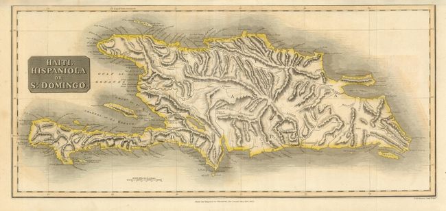
2) Haiti, Hispaniola or St. Domingo, John Thomson, New General Atlas, 1815 (23.8 x 10.8"). This is the lower half of a two-part map engraved by J. & G. Menzies. It provides excellent detail of the topography of the island.
References:
Condition: A
Fine crisp impressions and color with light toning in margins of map #1.