Subject: Alaska
Period: 1867-1908 (dated)
Publication:
Color:
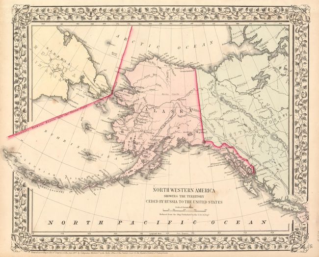
1) North Western America showing the Territory Ceded by Russia to the United States, from S.A. Mitchell's New General Atlas, 1867, original hand color (14.5 x 11.5"). This very early map of Alaska is dated the same year the territory was purchased from Russia, in what was then known as Seward's Folly. It shows Alaska with no organized boroughs and the interior virtually blank, save for the occasional river and Fort Yukon. Just a few villages are named and there is no sign of Mt. McKinley. Sitka is called New Archangel. It is one of the first atlas maps of Alaska Territory. Nice impression with two minor spots in the title (B+).
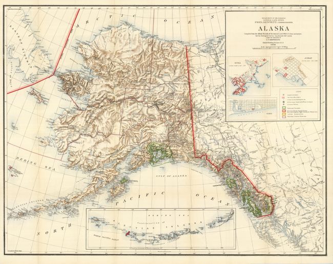
2) Alaska Compiled from the Official Records of the General Land Office U. S. Coast and Geodetic Survey …under the direction of I.P. Berthrong, 1908, printed color (38 x 29.8"). This huge and very handsome map of the territory is filled with a remarkable amount of information and details. This edition, updated to 1908, includes large insets of the Aleutian Islands, plus town plans of Sitka, Juneau and Nome. The legend keys to cities, towns and settlements, National Forests, Military Reserves including Naval and light houses, Indian Reservations, and Reindeer Station Reserves. No sign of Anchorage in the area, but Ladds Station, Hope, Sunrise and Knik Station are located. Compiled by M. Hendges, revised and drawn by Charles J. Helm. A very graphic and striking map in fine condition (A+).
References:
Condition:
See description.