Subject: Central United States - Railroad
Period: 1878 (dated)
Publication:
Color: Black & White
Size:
14.2 x 10.2 inches
36.1 x 25.9 cm
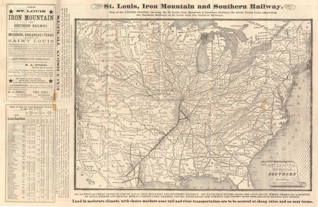
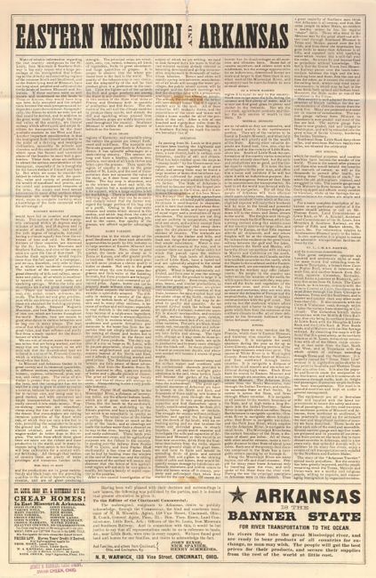
This is an advertising broadside promoting land for sale in eastern Missouri and Arkansas. On one side is the large map "St. Louis, Iron Mountain and Southern Railway. Map of the United States, Showing the St. Louis, Iron Mountain and Southern Railway, the Great Trunk Lines, Connecting the Northern Railways at St. Louis with the Southern Railways" (14" x 12") with the title contained in a fancy scroll. This map focuses on the railroads' routes and stations from St. Louis through Arkansas and into Texas. In Texas the rail routes extend to Austin, Dallas, Columbia, Galveston and Waco. The verso contains over 70 column inches of promotional prose describing the region in the finest of terms and ascribing the sparse population to "the want of reliable information" on the area's charms. One advertising panel titled "Cheap Homes!" suggests that two crops can be grown on the same ground each year and where there are "Good People" and "No Grasshoppers." A great land promotional broadside published by the railroad. At bottom in margin is the agent's stamp in purple ink: Henry H. Hannan, Land Agent, Swan Creek, Ohio.
References:
Condition: A
The map itself is very good with only a small and light area of stain near Richmond. Outside the map on a fold is a mirror of the stain and at left edge is small loss at fold that affects no text.