Subject: Southern United States
Period: 1831-32 (dated)
Publication: The History and Topography of the United States
Color: Black & White
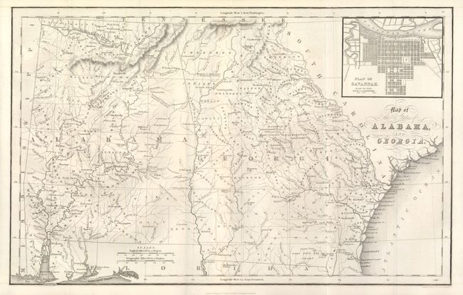
1) Map of the States of Alabama and Georgia, 1831, (15.8 x 10"). An early map of the states with early county configurations, particularly in Alabama. Excellent detail, including mountains, rivers, roads, lakes, towns, Indian tribes, and a host of other details. Inset plan of Savannah at upper right.
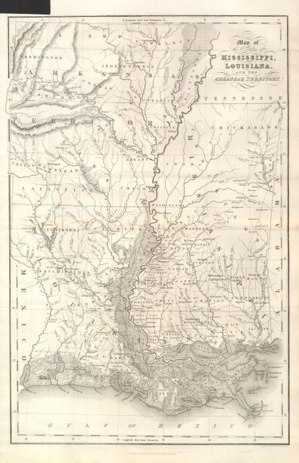
2)Map of the States of Mississippi, Louisiana and the Arkansas Territory, 1832, (10.5 x 16"). Great depiction of Arkansas Territory.
3)
References:
Condition: A+
Clean and bright examples.