Catalog Archive
Auction 132, Lot 162

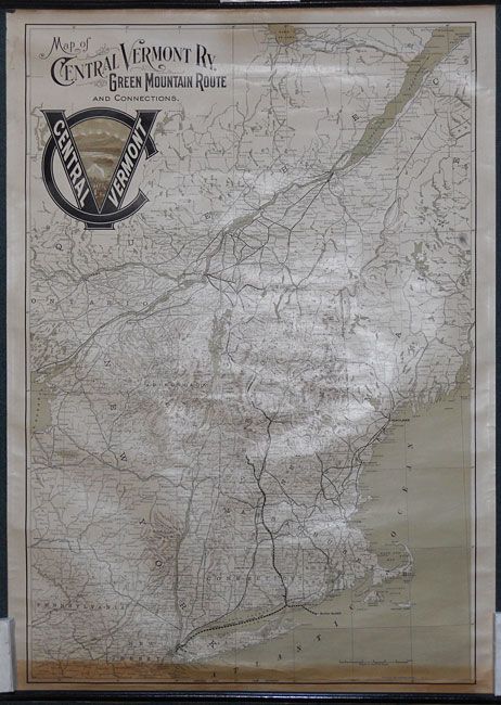
"Map of Central Vermont Ry. Green Mountain Route and Connections", Poole Bros.

Subject: New England

Period: 1901

Publication:

Color: Printed Color

Size:
25.6 x 37.4 inches
65 x 95 cm
Download High Resolution Image
(or just click on image to launch the Zoom viewer)

This small wall map details the route of the extensive rail network within New England south to New York City and into Canada with the line ending at Quebec. Fancy Victorian-style titling and large (7") logo that includes a pictorial view. Lithographed in brown, olive and black the map is quite handsome. Terrain indicated via hachure. Blank verso. 100% original with rollers top and bottom.

References:

Condition: B+

The map is generally very good to fine, but the lower 2" are toned, apparently from lower roller. Both rollers attached and are fine.

Estimate: $150 - $200

Sold for: $110

Closed on 6/2/2010

Archived