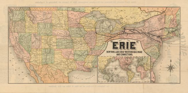
Subject: United States - Railroad
Period: 1882 (dated)
Publication:
Color: Printed Color
Size:
31.5 x 14 inches
80 x 35.6 cm
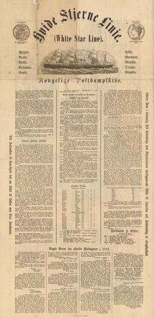
This very scarce folding broadside was published by White Star Line for a German audience, who apparently were considering immigrating to the United States or perhaps Australia. The separately issued broadside is laid out in newspaper fashion with a masthead showing a beautiful four mast, twin stack steam ship. On the verso is a fine map of the United States with railroads boldly shown. The large inset map of the world shows steamer routes to the United States from Australia, China and Europe with onward routes through the Suez Canal. On a sheet of thin paper 17" x 36". A terrific piece that was printed by the Rand McNally Co.
References:
Condition: B
The document is near fine except for four small areas of inset damage with slight loss, two in the lower portion of the map. Folding as issued.