Subject: Canada & United States
Period: 1838 (dated)
Publication:
Color: Hand Color
Size:
20.3 x 14.3 inches
51.6 x 36.3 cm
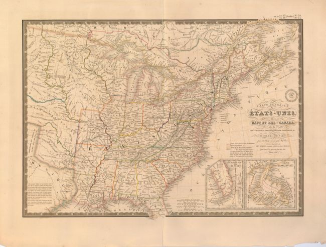
An uncommon and finely engraved map covering all the eastern United States to about the 100th meridian, with a bit of southern Canada. The western territories include Ter. Du Nord Ouest that encompasses present-day Wisconsin, the Upper Peninsula of Michigan, and Minnesota. The rest of the west past Missouri and Arkansas is designated as Indian Districts/i>. The eastern part of Texas is shown as part of Mexico. Insets of the tip of Florida and Newfoundland are located in the lower right. Embossed with the publisher's seal and surrounded in a decorative keyboard border.
References:
Condition: B+
Original outline color with some offsetting. There are some repaired tears and large chips in the bottom margin, none close to the map. A fold separation that just enters the border at top is closed on verso with linen hinge tape.