Subject: Colonial United States and Canada
Period: 1756 (dated)
Publication:
Color: Hand Color
Size:
30 x 22 inches
76.2 x 55.9 cm
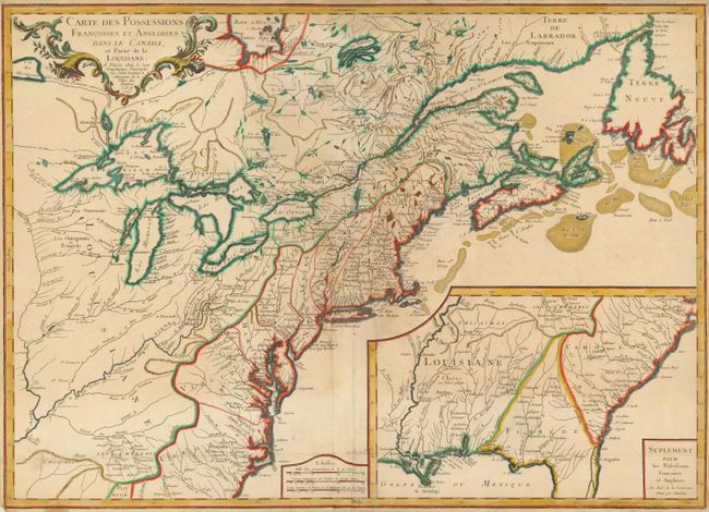
This is the first edition of this separately published map of the colonial United States and Canada. It was issued to provide information about the theater of the French and Indian War, which was formally declared in 1756 and continued until 1763. The map shows the region from Labrador and Hudson Bay across to Assiniboine Lake and south to the Carolinas, including the Mississippi and Ohio River valleys. The Great Lakes are mapped with the inclusion of the imaginary islands of Phelipeaux, Maurepas, and St. Anne in Lake Superior. The Southeast, excluding the southern tip of Florida, is shown in a large inset map. French Louisiane is between the Mississippi River and the Spanish territory of Florida, which extends north to the Monts Apalaches in a triangular shape. An amorphous Georgia is squeezed between Florida and Carolina. There are numerous Indian villages and early forts located.
References: Sellers & Van Ee #70; McCorkle #756.9.
Condition: C+
Some toning and small stains with narrow (1/16" - 3/16") margins. The map has been professionally repaired including a half-moon shaped tear at bottom center. The same shaped area at top center has been replaced with facsimile of the word Septentrio in the border.