Subject: Western Hemisphere
Period: 1725 (circa)
Publication: Altdorfini Atlas Manualis Scholasticvs…
Color: Hand Color
Size:
13.5 x 10.8 inches
34.3 x 27.4 cm
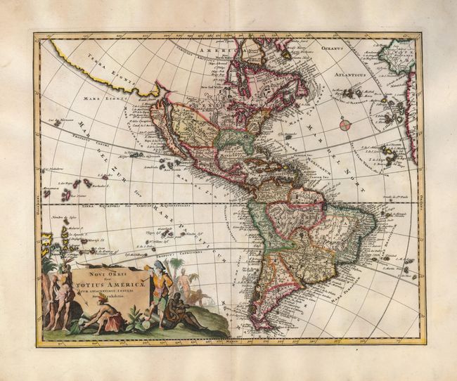
This is a fine map of the Americas featuring the mythical depiction of California as an island. Across the narrow strait, Fretum Aniani, is the kingdom of Anian and the large stretch of coastline noted as Terra Esonis. North America includes many interesting misplaced place names and cartographic errors: Louisiene and Apaches de Novajo appear to the northwest of the Great Lakes; two rivers flow past Santa Fe - one (R. del Norto) empties into the Gulf of California and the other (Magdalene Fl) flows in the approximate path of the Rio Grande and empties into the Gulf of Mexico; the Mississippi River delta is too far west; and a large lake appears in Carolina. Embellishing the southwest corner of the map is a highly pictorial cartouche featuring Indians, a pipe-smoking European, and several slaves.
References: McLaughlin #204; Tooley (Amer) p. 132 #90.
Condition: A
Near fine example with a dark, early impression and wide margins. A little light foxing or toning in the Pacific, still very good.