Subject: Geography, North America
Period: 1794 (dated)
Publication:
Color: Black & White
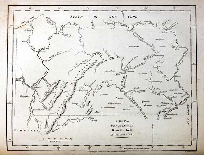
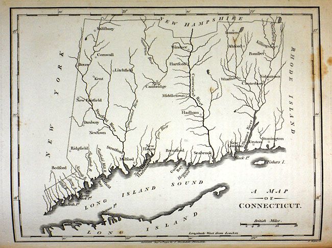
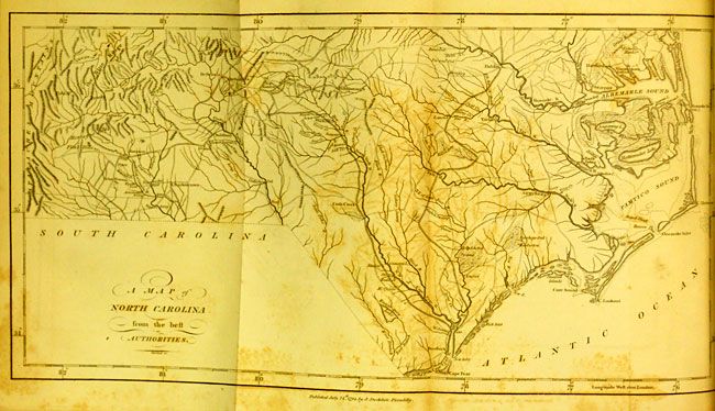
With the folding "A Map of the Northern and Middle States; comprehending the Western Territory and the British Dominions in North America from the best Authorities"; A Map of the States of Virginia, North Carolina, South Carolina and Georgia; Comprehending the Spanish Provinces of East and West Florida..."; "Map of Virginia Maryland and Delaware"; "A Map of North Carolina from the Best Authorities"; "A Map of South Carolina from the Best Authorities"; "A Map of the West Indies from the Best Authorities"; plus many other single page state maps. Hardbound in full leather, marbled end papers and foredges. Quarto, 716 pp., 25 of 25 copper engraved maps, many folding, Index. This is the John Stockdale edition published from London.
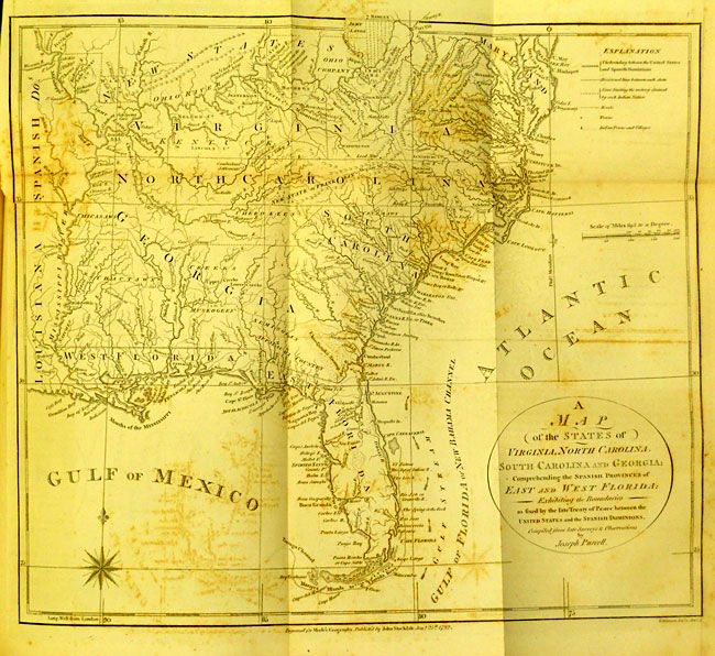
Of major interest is Joseph Purcell's map of Virginia, the Carolinas and Georgia (ref: Wheat & Brun #491). This very uncommon map of the early Southeast shows a well defined New State of Franklin, within the borders of North Carolina. In 1785, settlers in present-day western North Carolina and eastern Tennessee organized a state government to be named in honor of Benjamin Franklin. Congress turned down their appeal but the state maintained a legislature and governor until 1788. This ephemeral state appeared on a small number of maps into the early part of the 19th century. The map shows early settlements, including a Moravian Settlement in North Carolina, and the Cumberland Settlements in present-day Tennessee. The map also notes native tribes and various Bounty Land Grants lands along the upper Mississippi River. This edition was engraved by W. Harrison and published by John Stockdale on Jany. 25th, 1792.
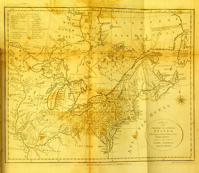
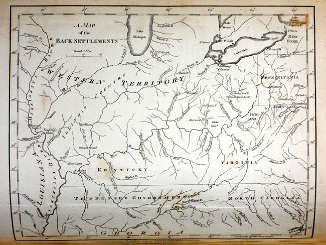
Also of interest is the map of the Northern and Middle States which describes the area from Maine (Province of Main), south to Virginia. Lesser detail extends west to the Great Lakes and the confluence of the Ohio and Mississippi Rivers, and north to eastern Canada up to James Bay. There are several Bounty Land Grants including Genl. Clarks, Donation Lands from the Commonwealth of Virginia, and Ohio Company in Ohio, and Wabash Company, New Jersey Company, and Illinois Company in Illinois. This is the first edition, with information taken from Amos Doolittle's map of the same title. Engraved by G. Allen Sanders, Wells Row, Islington and published by Stockwell as noted above.
References:
Condition: B
Middle states map with heavy foxing, some other maps also with significant scattered foxing but most are good to very good. Covers and spine are mostly perished, covers detached. Contents sound and very tight save for first & last end paper which are loose.