Catalog Archive
Auction 131, Lot 844

"[Lot of 2] Nouvelle Carte de l'Isle de Java… [and] Carte Particuliere des Isles Moluques. Byzondere Kaart der Molukze Eylanden", Bellin/Van Schley

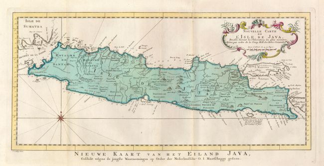
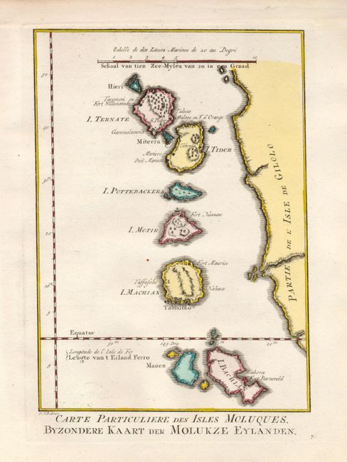
Subject: East Indies - Indonesia

Period: 1773-80 (circa)

Publication: Raynal's Atlas Portatiff

Color: Hand Color

Size:
See Description
Download High Resolution Image
(or just click on image to launch the Zoom viewer)

1) Attractive chart of the island depicting soundings around the coast, all principal harbors, rivers and elevations, bays and points, settlements and provinces. Included are Madura, Bali, Sunda Strait and the southeastern tip of Sumatra. The island is divided into provinces and the kingdoms of Bantam, Tsieribon and Jacatra. A nice compass rose and decorative title cartouche complete the map. Titled in Dutch below the map, Nieuwe Kaart van het Eiland Java… (17.3 x 8") 2) Delicately engraved map representing the western coast of Irian Jaya and the Maluku Islands, the famous Spice Islands that were the cornerstone of the Dutch trading empire in the East Indies. The map locates the settlements and forts on each island. (6 x 9")

References:

Condition: A+

Fine impressions and original color.

Estimate: $275 - $325

Unsold

Closed on 3/17/2010

Archived