Catalog Archive
Auction 131, Lot 835

"A Chart of ye East-Indies, with the Coast of Persia, China also the Philipina, Moluca and Sunda Islands &c.", Moll, Herman

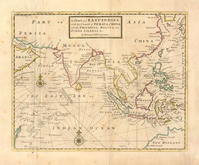
Subject: South East Asia

Period: 1717 (circa)

Publication:

Color: Hand Color

Size:
13.8 x 10.8 inches
35.1 x 27.4 cm
Download High Resolution Image
(or just click on image to launch the Zoom viewer)

This map covers the coastlines and islands from the Persian Gulf and Madagascar through the Philippines and Indonesia to the coast of Australia. There are details of even very small islands and atolls and fishing banks are located in the Indian Ocean. The Straits of Sincapora (Singapore) are named. Australia is labeled as New Holland with De Wits Land, and Dimens Land noted (references to the early Dutch explorations in the region).

References:

Condition: B

Nice impression with original color and some scattered foxing.

Estimate: $180 - $240

Sold for: $130

Closed on 3/17/2010

Archived