Subject: Portugal
Period: 1685 (circa)
Publication:
Color: Hand Color
Size:
22.6 x 20 inches
57.4 x 50.8 cm
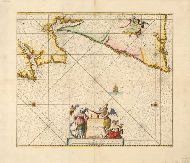
This very handsome engraved sea chart shows the coast of Portugal from Lisbon to the Cape Saint Vincent (Vila do Bispo). Lisbon is shown as a large fortified city with ship anchorages located as well a few soundings in the bay. Across the bay are large salt collection fields. Further south across from Setubal are even larger sea salt areas. The coastal shores contain a few place names along the Atlantic. The large pictorial cartouche includes Mercury and allegorical figures representing death & time as one figure and a female holding a flaming lantern with her eyes covered with a cloth that is being lifted by death. North is oriented to the left of the chart and indicated by two fine compass roses and a large array of rhumb lines. This large map is printed on two sheets joined as issued.
References:
Condition: A
Fine impression and wide margins. Two tiny matching spots in ocean.