Catalog Archive
Auction 131, Lot 438
"Tabula Novissima atque Accuratissima Caraibicarum Insularum sive Cannibalum quae etiam Antillae Gallicae Dicuntur Item Insulae Supraventum, et in Archipelago Mexicano", Ottens, Reiner and Joshua
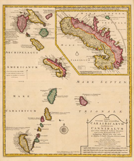
Subject: Lesser Antilles
Period: 1728 (circa)
Publication:
Color: Hand Color
Size:
19.5 x 23 inches
49.5 x 58.4 cm
Download High Resolution Image
(or just click on image to launch the Zoom viewer)
(or just click on image to launch the Zoom viewer)