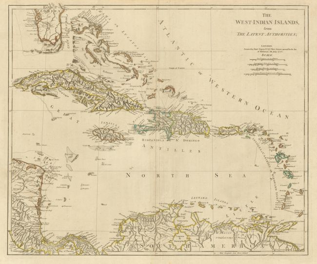
Subject: Caribbean
Period: 1772 (dated)
Publication:
Color: Hand Color
Size:
22.7 x 19 inches
57.7 x 48.3 cm
This is a very scarce map of the West Indies covering from the tip of Florida through to the northern coast of South America. Florida is depicted with a large interior lake labeled Laguna del Espiritu Santo. The islands and banks of the Bahamas are well delineated as are all the small islands throughout the region. The map was likely drawn and engraved by Thomas Jeffreys, as the map is rendered in his precise engraving style. A previous owner has adhered three old (dated 1789 & 1793) printed descriptions of the islands, each describing the colonial possessions, industry, and population.
References:
Condition: A
Nice impression and original outline color with just a hint of surface soil.