Subject: Virginia
Period: 1867 (dated)
Publication:
Color: Hand Color
Size:
32.5 x 20 inches
82.6 x 50.8 cm
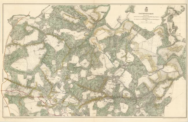
Minutely detailed Civil War map of the Battle of Totopotomoy Creek in Hanover County, Virginia in 1864. Numerous farms with the owner's name, woods, creeks, roads, troop positions and more are shown. Roughly centered on Hawe's Store, the map extends from Atlee's in the southwest to Mechanicsville in the northeast. This battle was waged on May 28-30, 1864 between Lt. Gen. Ulysses S. Grant and Maj. Gen. George G. Meade on the Union side and Gen. Robert E. Lee on the Confederate. The map was drawn from surveys by Maj. J.F. Weyss under the direction of Bvt. Brig. Gen. N. Michler, Major of Engineers.
References: Stephenson (CW) #663.2
Condition: A
Fine color and impression.