Subject: New Jersey
Period: 1825 (published)
Publication: Atlas Geographique, Statistique, Historique et Chronologique…
Color: Hand Color
Size:
24 x 17.3 inches
61 x 43.9 cm
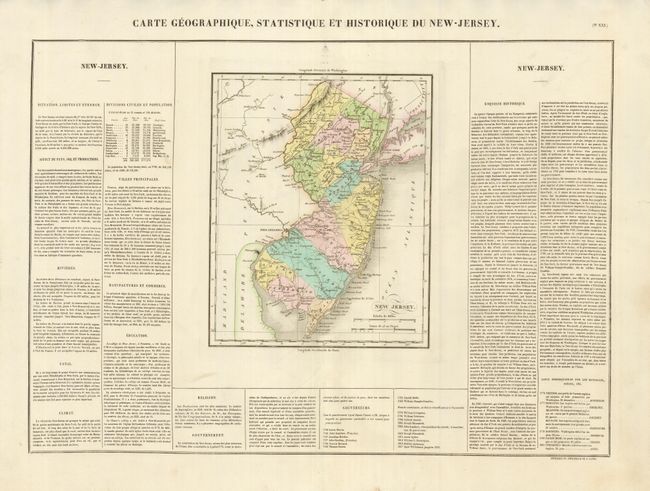
This delicately engraved map (9 x 11.3") shows the state with a population of about 280,000, a 13% increase from the previous census of 1810. It shows the modest network of wagon roads and numerous small towns and settlements including Leesburg, Longacoming, Dover, Freehold, Trenton, Hackensack, and many more but not including Jersey City. Great Egg Harbor and many other coastal features are located. A most handsome example of this map on a full folio sheet with surrounding text giving historical, physical and political information. A table lists all governors current to Isaac Williamson, 1822. Buchon produced the French edition of Carey & Lea's American Atlas. He used a better quality paper and today his maps are generally found in better condition than their American counterparts.
References:
Condition: A
The map has the original delicate hand coloring and a fine impression on a thick sheet with original margins. In Delaware the city of Wilmington has a small ink smudge from the printing process.