Subject: Boston, Massachusetts - Geography Book
Period: 1830 (dated)
Publication:
Color: Hand Color
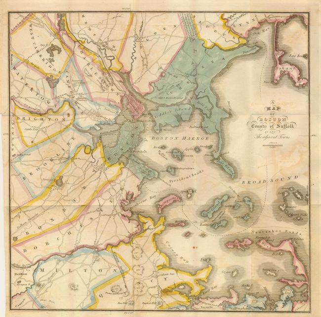
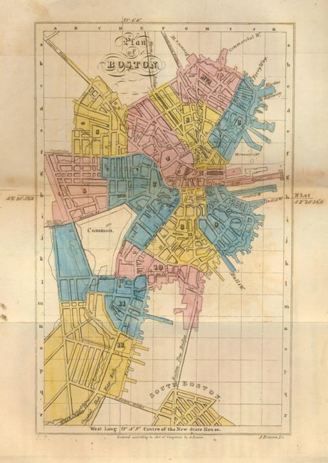
This is a scarce and early children's geography book of the greater Boston area. It was created by C.H. Snow, M.D. who also authored the "History of Boston." It contains fine descriptions of Boston and its wards as well as detailed information on each of the surrounding towns. With two finely engraved hand colored folding maps by A. Bowen. The first "Plan of Boston" (4" x 6") is fully colored by ward and extends to include part of South Boston with good detail of the major streets and along the wharfs. The second and larger map is "A Map of Boston County of Suffolk and Adjacent Towns." Finely engraved and detailed it measures 12"x 12". With original outline hand color of the townships except for Chelsea which is fully hand colored. This map shows topographical features as well as roads and other items of interest such as a "Cattle Fair" in Brighton, Harvard University, an Insane Hospital in Charlestown, and most notably the "Quincy Railway" in Quincy and Milton. This is considered to be the first commercial railroad in the US, beginning operations in 1826. It was constructed to transport granite for the Bunker Hill Monument and ran from Quincy to the Neponset River, a distance of 3 miles. Horsepower (the four legged kind) was used, not steam power. A small wood engraved illustration (page 159) shows this horse-drawn railway. Also delineates the Dedham Turnpike and another unnamed turnpike heading south along the coast. Names Nantasket Roads, Payne's Hill, Blue Hill and more. The book is illustrated with wood engravings in the text and an engraved front piece showing a horse drawn carriage on Tremont Street. Published from Boston by Carter and Hendee.
References:
Condition: B+
The Boston plan has some archival tape repairs at paper edge along one fold and a little foxing in margins. The regional map has a discrete closed tear from the binding trim and a couple small spots and light offsetting: sound but detached. Binding with some cracking along leather spine, contents sound and tight.