Subject: Florida
Period: 1899 (dated)
Publication: H Doc 286, 56th Congress, 1st Session
Color: Black & White
Size:
26 x 18.7 inches
66 x 47.5 cm
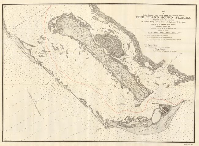
This chart is uncolored except for red overprinting used to delineate the center of the treacherous channel near Fort Meyers. Fully engraved with much inland detail it locates the islands of Captiva, Sanibel and Pine. Locates a lighthouse at the eastern tip of Sanibel Island as well as Blind Pass, Captiva Pass, Matlacha Pass, another lighthouse, with separate beacon and quarantine station on Casparilla Island, plus Charlotte Harbor, Bird Island and Shark Point. No settlements are drawn on the map but the village of St. James City is named on the southern tip of Pine Island. The Caloosahatchee River inlet to Cape Coral and Fort Meyers is noted. All waterways are filled with soundings in feet at the mean low tide. The chart was prepared at the direction of Captain Henry Jervey, Corps of Engineers, September - October, 1899. Signed in the plate by Captain Jervey.
References:
Condition: A+
Folded as issued. Flawless.