Subject: Connecticut
Period: 1855 (dated)
Publication:
Color: Hand Color
Size:
50 x 68 inches
127 x 172.7 cm
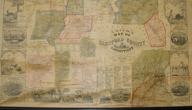
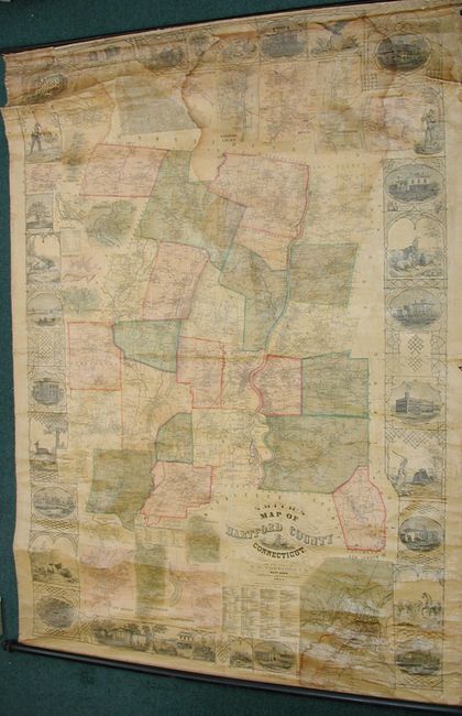
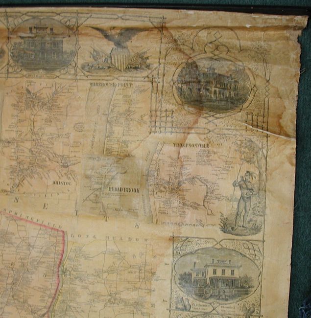
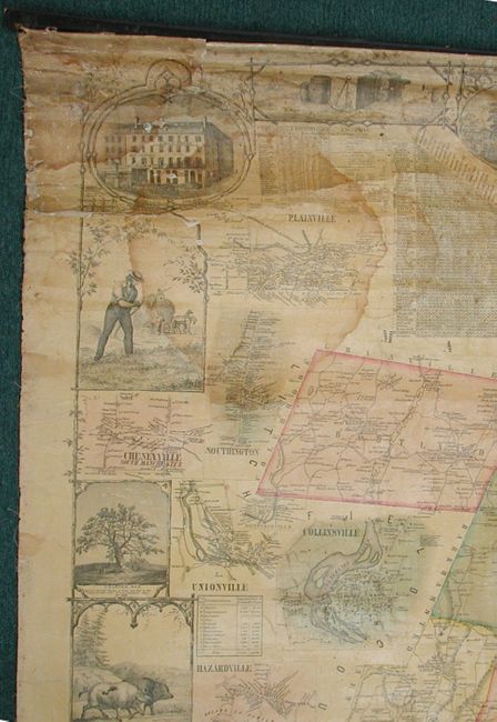
This spectacular rarity was drawn from an original survey by E.M. Woodford of West Avon. It covers the county in amazing detail with towns, villages, roads, trails, individual homes, watershed and topography well shown. Each township is separately hand colored. However, the main feature is the naming of hundreds of property owners throughout the entire county. Thompson notes that the map "locates every building in the county, with names of owners marked, excepting with the city of Hartford." The map is surrounded by a wide and complex border that incorporates thirty different scenes intertwined with graphic elements. The border scenes include the State House in Hartford, State Normal School in New Britain, Connecticut Literary Institution in Suffield, the home of Col. A. G. Hazard in Enfield, the elegant Residence of Wm. H. Jones with View of Silk Factory, the Charter Oak, wildlife, and an Indian Warrior. Twenty insets surrounding the map are large and detailed town plans of Hartford, Farmington, Rockyhill, New Britain, Wethersfield, Glastonbury (Glastenbury), South Glastonbury (Glastenbury), Windsor Locks, Thompsonville, Broad Brook, Warehouse Point, Plainville, Cheneyville, Southington, Unionville, Collinsville, Hazardville, Plantsville, and Berlin. With tables showing distances and another giving agricultural statistics. The large "Business Directory for the City Subscriber" lists businesses by type including Carriage Makers, Marble Makers, and many more. Fancy titling with flourishes. The map was engraved and printed by Wagner & McGuigan, and published by H. & C.T. Smith, both of Philadelphia. Complete with original wooden rollers top and bottom. This rare wall map is not in Phillips Maps of America, or the Rumsey collection, which does however contain a Smith wall map of New Haven County dated 1856. Thompson's research used three copies: the American Antiquarian Society, Connecticut Historical Society, and the New York Historical Society.
References: Thompson 164; Ristow, p.388.
Condition: B
In remarkable, unrestored condition. With water stains in top with some roughness along top including a few small areas of missing paper. Stain at lower right corner in the Hartford plan. With typical small cracks and one small area of loss in the map near Rockyhill. Varnish is fairly clear without the heavy darkening often seen on wall maps from this period. A straightforward restoration will make this a truly beautiful example.