Subject: Colorado
Period: 1879 (circa)
Publication: U.S. Geographical Surveys West of the One Hundredth Meridian
Color: Black & White
Size:
19.2 x 15 inches
48.8 x 38.1 cm
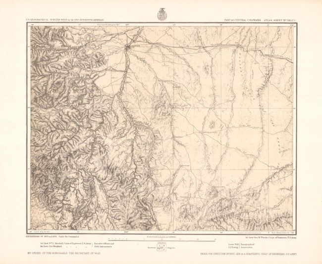
This was a period of intense effort by the likes of Clarence King, Ferdinand Hayden, John Wesley Powell, and the military to advance the knowledge of the West. Previously, surveys were undertaken as an adjunct to some overriding objective such as building a transcontinental railroad or during time of war. Lieutenant George Wheeler, Engineer Officer on the staff of the Commanding General of the Army, conceived of this important survey where the maps would be produced on a consistent scale. The resulting surveys and maps are one of the most important geographical works on the American West produced during the 19th century.
This map covers central Colorado and the drainage basin of the South Platte River with Denver in the upper left. It provides excellent detail of the topography, roads, rivers, springs, railroads, mills, mines, and quarries. Railroad lines shown include the Colorado Central, the Denver & Rio Grande, the Kansas Pacific, and the Denver Pacific. In addition to Denver, the map shows the settlements of Golden, Littleton, Castle Rock, Franktown, Larkspur, and several others that are no longer in existence.
References:
Condition: A+
Minor creases in blank margins, well away from the map.