Catalog Archive
Auction 131, Lot 274

"A New Map of Arkansas with its Canals, Roads & Distances", Thomas, Cowperthwait & Co.
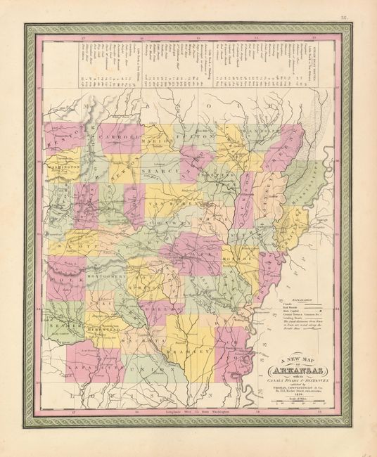
Subject: Arkansas

Period: 1850 (dated)

Publication: Mitchell's New Universal Atlas

Color: Hand Color

Size:
11.8 x 14.5 inches
30 x 36.8 cm
Download High Resolution Image
(or just click on image to launch the Zoom viewer)

An attractive and early map of Arkansas, showing county configurations for 1845. The map has many towns named, and a number of roads criss-cross the map. The number of miles between towns is helpfully noted, and at the top of the map the steam-boat routes are noted from Little Rock to New Orleans, Pittsburgh, and Fort Gibson. The map is surrounded in a decorative border.

References:

Condition: A+

Nice original color on a sturdy sheet with a little faint foxing in blank area.

Estimate: $80 - $120

Unsold

Closed on 3/17/2010

Archived