Subject: Northwestern United States
Period: 1873-83 (published)
Publication:
Color: Hand Color
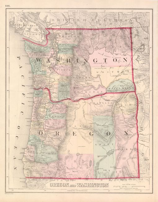
The first map (11.9 x 14.8") was published by F.A. Gray. It shows only 20 counties in Oregon and about 24 in Washington. Dated 1873, the map provides great topographical information drawn in hachure. The eastern portion of both are mostly unsettled with the majority of development along the coastal regions.
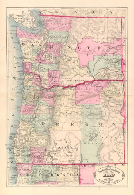
The second map is an early railroad map in hand color by George Cram, circa 1883, (11.5 x 17"). This map shows the remarkable amount of development and settlement that has taken place in one decade. The railroads are expanded and counties have changed only modestly in Oregon because the counties are up to date only to about 1881 as it does not show the addition of Klamath. In Washington the counties added in the 1870's are correctly shown but Garfield county, created in 1881, is missing.
References:
Condition:
The former is fine. The latter has a short split on centerfold just into map at left.