Subject: Western United States
Period: 1848-1850 (published)
Publication:
Color: Hand Color
Size:
5.5 x 9.3 inches
14 x 23.6 cm
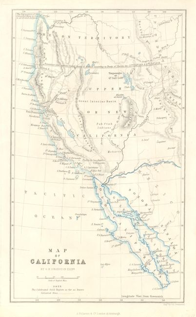
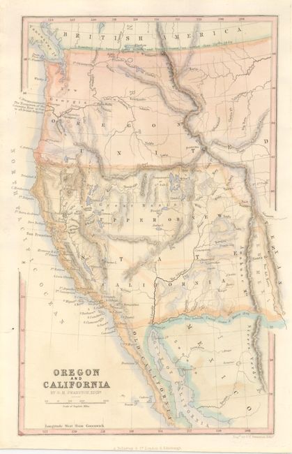
This pair of western maps show roughly the same area as J.C. Fremont's celebrated map of the west. Both are California Gold Rush period maps and are about from the same date, but the geography on each is noticeably different. G.W. Swanston drew and engraved both maps. They show a large Oregon Territory which stretches to the Continental Divide and north to the border with Canada. The first shows Pyramid Lake just south of the Oregon border with no sign of Lake Tahoe. The Gold Region is a large region of central California as delineate by a dotted and hand colored line. The entire Southwest is Upper or New California with no suggestion of California's statehood. This map is mostly black & white with some outline blue to the shorelines. The second map corrects the position of Pyramid Lake but there is still no indication of Bigler Lake or Lake Tahoe. There is not a direct mention of gold mining activities but the important ore bearing rivers are shown and named. Fully hand colored. A great pair of matching smaller maps.
References: Wheat (TMW) #693 (second map).
Condition: A+
Both are very nice examples.