Subject: Midwestern United States
Period: 1831 (published)
Publication: History of the United States
Color: Hand Color
Size:
15.5 x 9.7 inches
39.4 x 24.6 cm
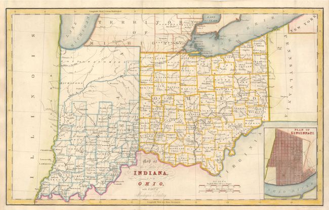
This attractive early 19th century map shows with early county configurations, particularly in Indiana where the northern half is shown to be the territory of the Pottowatomies and Kickapoos. The lone exception is Allen County with Ft. Wayne, which provided a defense against the Indian frontier. In southern Michigan Territory only Washtenaw, Wayne, Lenawes and Monroe counties are shown to be organized. There is excellent detail throughout, including mountains, rivers, roads, lakes, towns, Indian tribes, and a host of other details. An inset plan of Cincinnati is at lower right.
References:
Condition: B+
Issued folded, now flattened with the binding side (at left) margin replaced to better accommodate framing.