Subject: Midwestern United States - Ohio & Indiana
Period: 1822-1825 (dated)
Publication:
Color: Hand Color
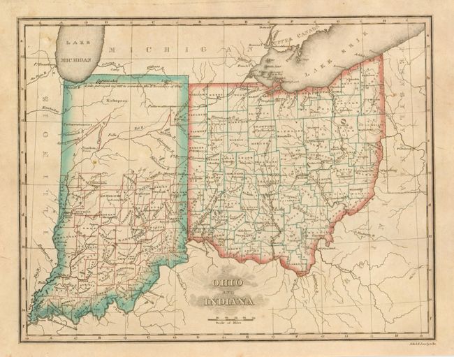
Ohio and Indiana,by Morse, circa 1825, 9.8 x 7.6". This map is a detailed and finely engraved map of Indiana and Ohio that was engraved by Jocelyn for Sidney Morse's Atlas. It is a later issue than the map illustrated in Rumsey with a date of 1823. The counties and states have original outline hand color. While Ohio is filled with counties most of northern Indiana is shown as one large undesignated area. It comes with its original one page index sheet. Some light scattered toning (B+). The index sheet has overall foxing and offsetting or pressed flower marks.
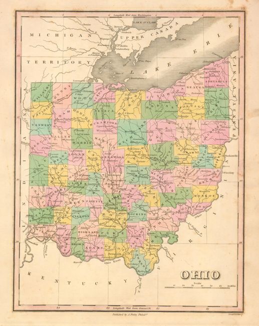
Ohio, by Anthony Finley, 1822, 8.5 x 11.2". This map has original hand color by county. Beautifully engraved to show towns and cities as well as early roads. County development suggest a date of 1822 or earlier as Lorain County is not shown. Engraved by Young & Delleker. It is bright and mostly clean with a few small areas of foxing and soiling mostly in margins (B+).
References:
Condition:
See individual descriptions.