Subject: Midwestern United States
Period: 1797 (dated)
Publication: Nuovo Atlante Geografico Universale
Color: Hand Color
Size:
18.8 x 13.5 inches
47.8 x 34.3 cm
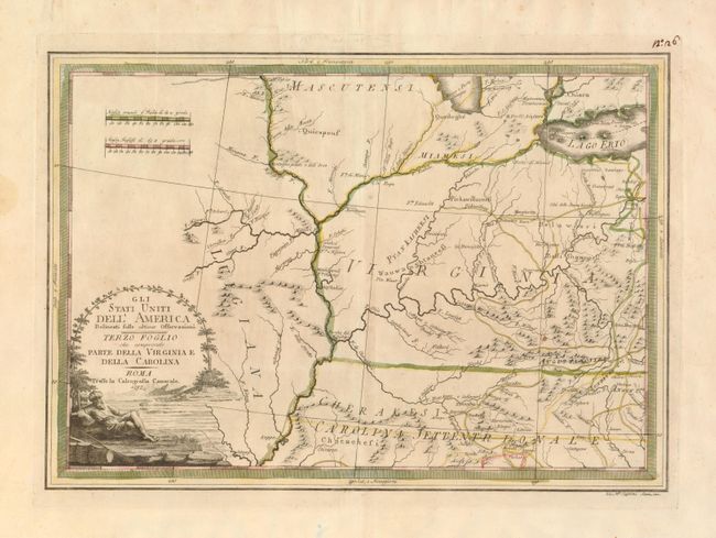
This uncommon map is part of Cassini's six-sheet representation of the settled portions of North America, now part of the new United States. Cassini drew largely from the Zatta-Mitchell map of North America. This sheet is focused on the Mississippi and Ohio River valleys, showing portions of Lakes Erie and Michigan at top; the latter with the note of Fiume e Porto Chicagou near present-day Chicago. The interior is identified as Virginia and North Carolina Territory, but it covers present-day Indiana, Ohio, Kentucky, and portions of Missouri and Tennessee. The native tribes are noted, and the forts and roads are located along with a number of towns. The map is decorated with a landscape cartouche showing a turbaned man lounging on the shores of a river.
References: Portinaro & Knirsch #166.
Condition: B+
Lightly toned with original outline color. A professionally repaired tear enters the map just above the distance scales and is now nearly invisible. A manuscript ink page number is in the top right corner outside the neatline.