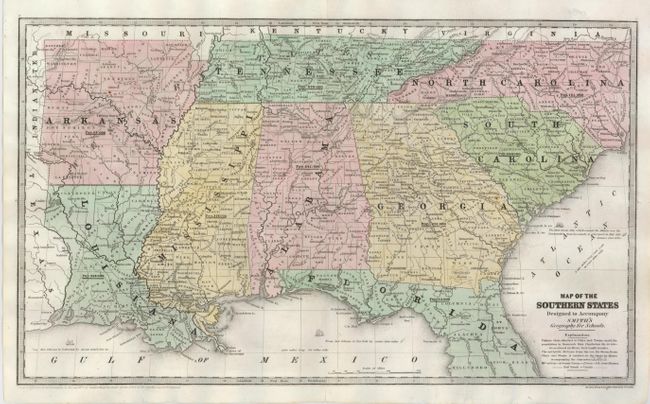
Subject: Southern United States
Period: 1839 (dated)
Publication: Smith's Geography for Schools
Color: Hand Color
Size:
17.5 x 10.3 inches
44.5 x 26.2 cm
Very finely engraved map of the Southeast to include Arkansas, Louisiana, Mississippi, Alabama, Tennessee, the Carolinas, Georgia and Florida down to Hillsboro County. Each county is individually engraved and the map is filled with towns and villages, roads, railroads and watershed detail. Notation offshore from Savannah says "The first Steam Ship which crossed the Atlantic was the 'Savannah' from Savannah to Liverpool, in May 1819. Distance 4250 miles." The population is given for each state under the state's name. The copyright notice of Daniel Burgess is below the neatline. A beautiful example.
References:
Condition: A
Professionally repaired to close a tear off the coast of Georgia. Lovely impression and color with original margins.