Subject: Southern United States
Period: 1825 (published)
Publication: Atlas Universel
Color: Hand Color
Size:
20.6 x 18.2 inches
52.3 x 46.2 cm
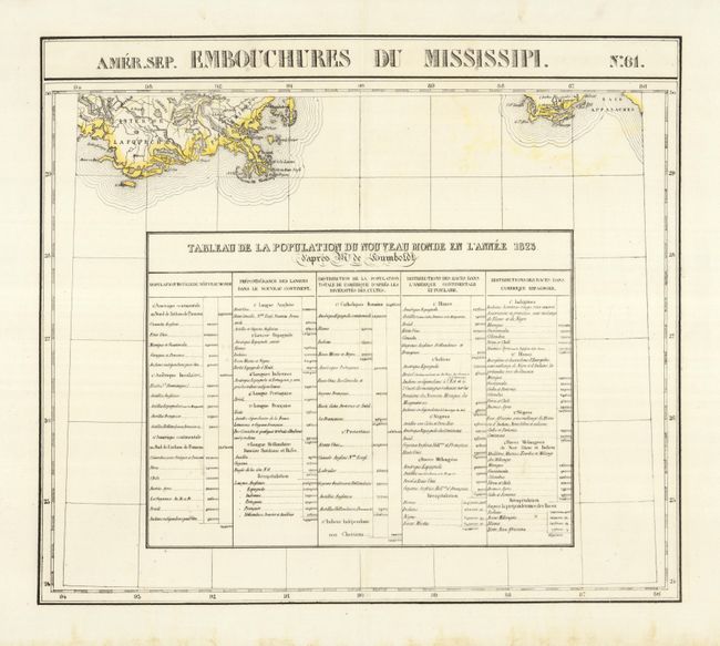
This rare chart details the delta of the Mississippi River south from New Orleans, and part of the Gulf coast at Apalachicolao and the region just west of Mobile, including the Pascagoula area, Dog Island, Deer Island, St George, St. Joseph, St. Blas, etc., Port St. Joe, and Apalachee Bay. Below the coastline is a large table "Tableau de la Population du Nouveau Monde en l'Annee 1823" which gives the population throughout the Western Hemisphere by race and religion. The Atlas Universel was the first atlas to present all the maps on the same scale (1: 1,641,836), with each map covering an area of approximately 20 degrees longitude (from Paris) and 6 degrees of latitude. It was also considered to be the first lithographic atlas ever published. The maps were meant to be joined together to form a huge globe measuring 7.775 meters in diameter. There was only one edition of the atlas, published in 1825-27, and the subscription list shows that only 810 copies were sold.
References:
Condition: A
Crisp impression on thick paper with wide margins. Fine less a small amount of light color offsetting below Florida and some foxing in lower blank margin.