Subject: New England
Period: 1833-40 (circa)
Publication:
Color: Hand Color
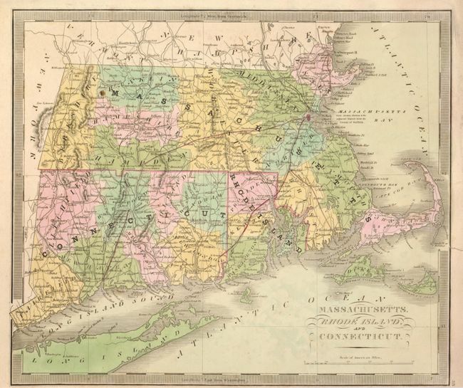
This great pair of maps share a common title. The first is by David H. Burr, 1833, 12.5 x 10.7". It shows county organization and settlement at the time. The map has full original wash color and a keyboard-style border. It details roads, towns, villages and settlements, ports, watershed and more. This edition is without a page number. Burr was appointed to be topographer to the U.S. Post Office Department in 1832 and was unable to complete the maps for this atlas. Thomas Illman assumed responsibility to complete the atlas, publishing it in 1835 using the New York firm of D. S. Stone. Full margins, beautiful impression and original hand coloring (A+)
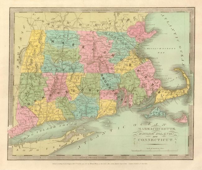
The second map is by Jeremiah Greenleaf, circa 1840, and measures 12.5 x 10.3". It is a handsome map with a keyboard-style border that details the roads, towns and villages, ports, watershed and more. Railroads are well shown in red hand color. Includes Martha's Vineyard and part of Long Island. Very little is known about the history and editions of Greenleaf's atlases, but this map is reportedly from a dated 1842 atlas. Maps by Greenleaf are uncommon and are highly sought after. Fine impression and original hand coloring. Short closed marginal tear at right just touches border and close trimmed at bottom, otherwise very good (B+).
References:
Condition:
See individual descriptions.