Subject: United States
Period: 1877 (dated)
Publication:
Color: Black & White
Size:
27 x 14 inches
68.6 x 35.6 cm
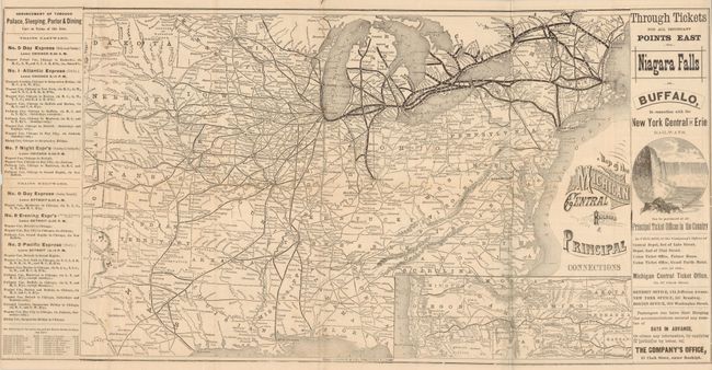
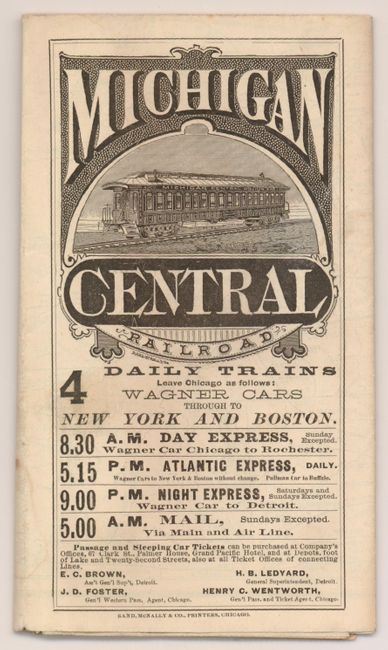
This is an early and well printed railroad system map and timetable. The map shows the primary routes between Boston and Portland, ME westward to Chicago. Other routes are shown as far south as New Orleans and into Texas and just to Colorado. Two insets delineate rail lines in the Northwest from the Dakotas to Washington and Oregon. The timetable on the map's verso is dated January 3, 1877. It features a large wood engraving showing diners in the "First-Class" dining car. Self folds into covers with the line's logo and interior and exterior images of the "Michigan Central Dining Car." Printed by the Rand McNally Company in Chicago.
References:
Condition: B+
A couple small fold intersection splits and some timetable panels with light soiling.