Subject: United States
Period: 1825 (dated)
Publication:
Color: Hand Color
Size:
20 x 14.3 inches
50.8 x 36.3 cm
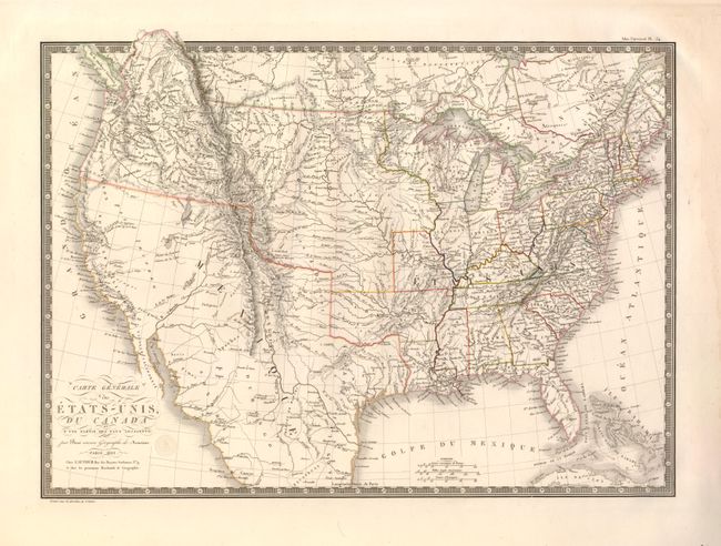
This handsome and finely engraved map covers the United States with most of Mexico and a bit of Canada. The United States are shown with their claims into British Columbia (Territoire Oregon) and Mexico still controls all of Texas and the Southwest, most of which is blank with only conjectural topography shown. The West also features some fictitious rivers, including the S. Buenaventura, flowing from the Rockies into Salt Lake, and then conjecturally through the Pay Inconnu (unknown land) to the Pacific. Two dotted lines trace the course of two rivers from L. Timpanagos to the Pacific. Farther south the Rio de la Pyramyde is suggested near the short Rio de los Martires, both of which appear to go nowhere. The western territories include North West Territory (encompassing present-day Wisconsin, Minnesota and the Upper Peninsula of Michigan), and the large Arkansas Territory.
References:
Condition: A
Original outline color and nice impression. There are faint damp stains in the wide original margins