Subject: Western Canada & United States
Period: 1797 (published)
Publication: Atlas du Voyage de La Perouse
Color: Black & White
Size:
27 x 19.5 inches
68.6 x 49.5 cm
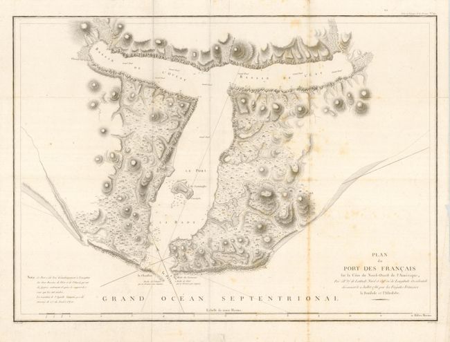
Fine, large chart of Lituya Bay, located within Glacier Bay National Park, along Alaska's southeastern coast. La Perouse discovered the bay in 1786 and named it Port des Francais. He hoped to make it France's major port in the Pacific Northwest and described it as "perhaps the most extraordinary place in the world." He soon discovered what makes the idyllic bay famous today; high (10 feet) tides and strong (14 mph) tidal currents. Twenty-one of La Perouse's men perished in the tidal currents while they were attempting to sound the waters at the narrow entrance. La Perouse built a monument to the lost men on the island in the center of the bay, which he named Cenotaph (meaning empty tomb) Island. Wide original margins with deckle edge at bottom and a paper flaw in lower blank margin from paper manufacturing. One line of foxing spots otherwise fine (B).
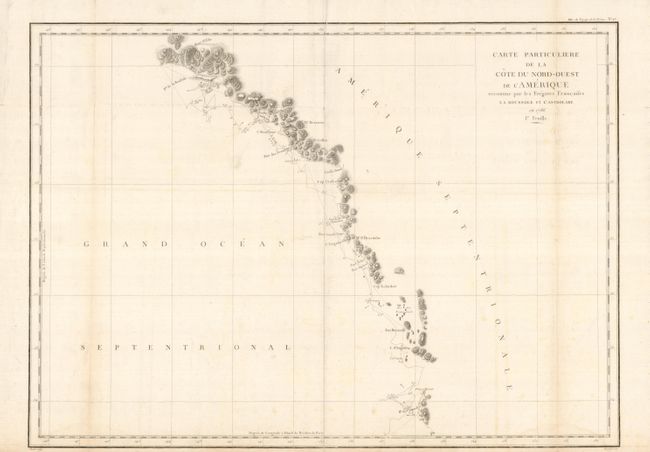
The second chart is a large-scale map of British Columbia and the southeast coast of Alaska. It details the route of La Perouse's voyage with only those parts actually surveyed from Bay de Clonard (Graham Island) to Mt. St. Elias. Unexplored areas being left completely blank. A few scattered light spots, one light fold tone and a light watermark at lower right (B+).
References:
Condition:
See individual descriptions.