Catalog Archive
Auction 131, Lot 147

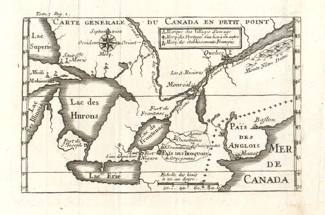
"Carte Generale du Canada en Petit Point", Lahontan, Louis Armand

Subject: Colonial Canada & United States

Period: 1704-09 (published)

Publication: Nouveau Voyages

Color: Black & White

Size:
5.5 x 3.5 inches
14 x 8.9 cm
Download High Resolution Image
(or just click on image to launch the Zoom viewer)

The early and inaccurate geography on this map begins with a distorted Michigan and extends eastward to show most of the St. Laurence. Names Boston (Baston), Fort Niagara, Manhattan (Manat) but without Long Island, Fort de St. Joseph, Makinac, Saut Ste. Marie, Montreal and Quebec. The legend locates Portages, Indian Villages, and French Settlements. Blank verso. This rare French edition is Plate 187 in Kershaw with the acute "e" in Lac Erie and at upper left "Tom. 1 Pag. 1".

References: Kershaw Vol.I No. 283; Karpinski (MI) p.53.

Condition: B+

Map itself is fine, but binding trim just into neatline at right with old paper laid in to provide full margin.

Estimate: $250 - $300

Sold for: $180

Closed on 3/17/2010

Archived