"Carte des parties Nord et Est de l'Asie qui comprend les Cotes de la Russie Asiatique le Kamschatka, le Jesso, et les Isles du Japon", Robert de Vaugondy, Didier
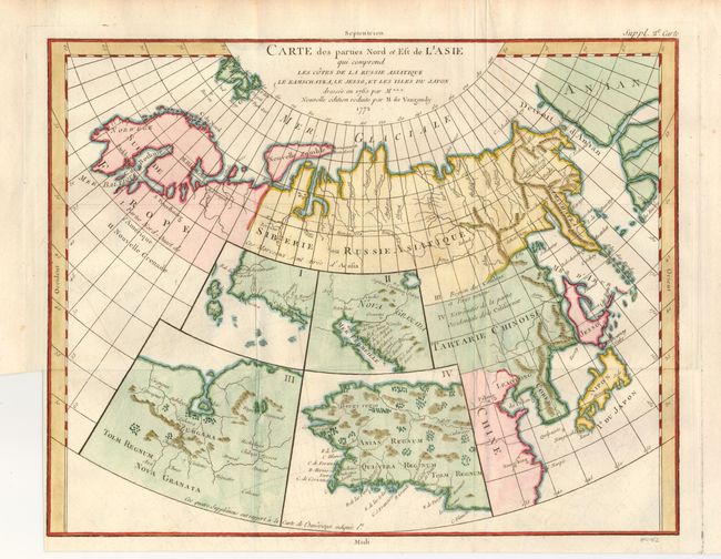
Subject: Northern Asia and Western North America
Period: 1772 (dated)
Publication: Diderot's Encyclopedie
Color: Hand Color
Size:
15 x 12 inches
38.1 x 30.5 cm
This unusual map details the northern coastline of Russia (including Finland), the eastern coast of Asia to below Nanking, and a bit of the coast of America called Anian. Inset into the map are four small maps of the western part of North America: I - Features the entire western coast with Japan just a short distance offshore; II - Focuses on Nova Granada showing the Mexican coast of the Gulf of California; III - Focuses on the Zubgara and Tolm Regnum of Nova Granada and the mythical seven cities of Cibola; and IV - Depicts Anian Regnum including Quivira Regnum and another Tolm Regnum. All together a fascinating view of some of the early cartographic theories concerning the western part of North America.
References: Pedley #406. & p. 79; Wagner (NW) #637.
Condition: B+
Issued folded, now flattened. The binding trim at lower left leaves 1/16" margin.