Subject: Jamaica
Period: 1773 (published)
Publication: Universal Magazine,
Color: Black & White
Size:
14.3 x 10 inches
36.3 x 25.4 cm
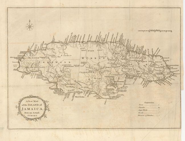
This finely engraved map of Jamaica shows counties and parishes, roads, sugar works, and churches in the interior and islands, bays, harbors, shoals, and landmarks along the coastline. The four corners are filled with a compass rose, scale of miles, explanation key, and the title cartouche, making an attractive composition. The cultivation of sugar cane and coffee made Jamaica one of the most valuable possessions in the world for more than 150 years. The British colony's slaves, who vastly outnumbered the colonists mounted several major slave conspiracies and uprisings throughout much of the 18th century. This map was issued during a period when the House of Assembly and governor were arguing with the British government over how best to control the situation.
References: Jolly UNIV-169; Sellers & Van Ee #1928.
Condition: B+
Issued folded, now flattened with fold intersections and a short binding tear professionally repaired. The binding trim at lower right leaves 1/16" margin. There is some faint offsetting.