Subject: Washington
Period: 1898 (dated)
Publication:
Color: Printed Color
Size:
62.5 x 42 inches
158.8 x 106.7 cm
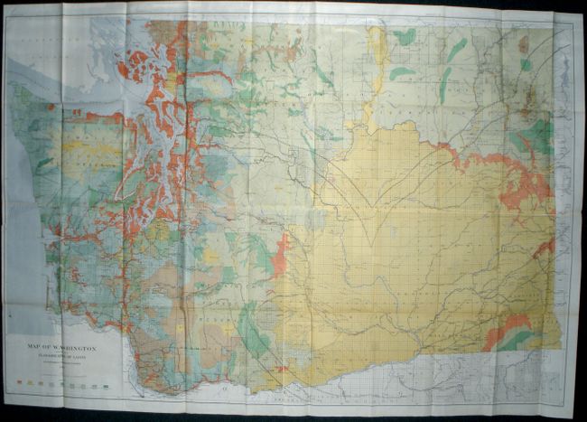
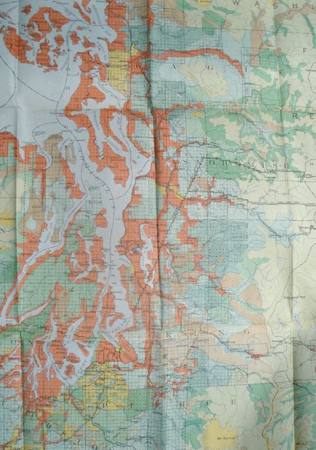
This huge and colorful map is on four joined sheets, as issued, and shows the state in immense detail on a scale of 5 miles per inch. Details include towns, villages, roads, railroads, watershed, topography and coastal detail. The large Jefferson Forest Reserve occupies the northern portion of the Olympic Peninsula and the Rainier Forest Reserve surrounds Mt. Rainier. The map derives its bright color from nine different classifications of land based on the forest density. The legend delineates via color and pattern the amount of board feet per acre plus those areas burned, timberless and cut. Drawn by George H. Plummer, F.G. Plummer and J.H. Rankine. Lithography by the firm of Julius Bien. An exceptional large map that is rarely offered.
References:
Condition: A+
Bright color and strong impression. Highly uncommon for a folding map of this size to be flawless.