Subject: Michigan
Period: 1822 (published)
Publication: A Complete Historical, Chronological , and Geographical American Atlas
Color: Hand Color
Size:
10.8 x 14.5 inches
27.4 x 36.8 cm
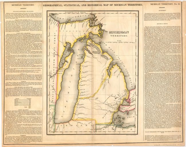
This is the first separate map of Michigan Territory. There is no development and little detail with the exception of a few forts and towns along the coast of Lake Erie and Lake St. Clair, and a new settlementon the Saganaw River. Ft Brown and Camp Smith are also located south of Green Bay, which was at this time a part of Michigan Territory. The Indian Line separates the territory roughly in half, with four counties named, but undesignated, in the southern section. There are notes locating portages and Fertile Land. There is a road shown connecting Ft Wayne, Indiana with Mr. Clemens. Two panels of English text flank the map providing fascinating details of the new territory and noting the total population at 8,896. Sheet with the text measures 21.7 x 17".
References: Karpinski #91 & p. 228.
Condition: B
Dark impression with original outline color. Some toning, darker along centerfold. Top margin trimmed to neatline surrounding text with a few edge tears in margins.


