Subject: Dakota Territory & Wyoming
Period: 1879 (dated)
Publication: Cram's Standard American Atlas of the United States
Color: Hand Color
Size:
21.5 x 28 inches
54.6 x 71.1 cm
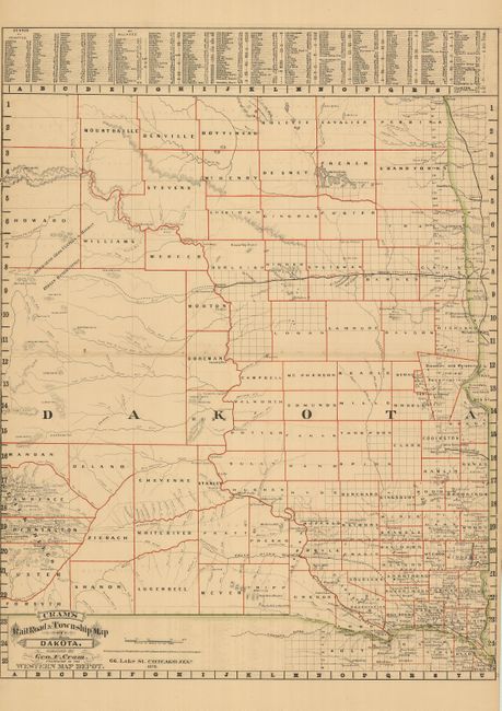
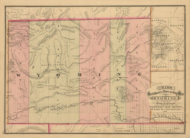
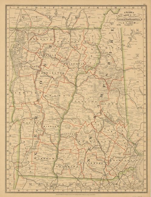
Rare map from the first edition of Cram's most celebrated atlas. This large double-page map has excellent detail throughout, locating scores of towns and villages, forts and Indian reservations. The extensive watershed is delineated and the topography is shown via hachure. The nascent railway system extends only to Bismark from Fargo, and in the south a short line to Yankton. Future rails are shown via dotted lines. On the verso is a great map of Wyoming Territory which has only five counties; also Vermont/New Hampshire. The map is dated 1879 with a copyright date of 1878. The imprint is Cram's Western Map Depot, 66 Lake St. Chicago, Ills. There was a close relationship between the Cram and Watson firms, who also published from this address. This Lake Street address was the home to Cram's publishing company between 1873 and 1879, thereafter moving to Wabash Avenue. These maps were published back to back and there is an equally fine single page map of Wyoming on the verso. This edition, unrecorded in Blevins, is two years earlier than Blevins #445. Five counties make up the entire territory, namely Uintah, Sweetwater, Carbon, Albany and Laramie. In 1875 Pease (renamed to Johnson in 1879) and Crook counties were established, but neither appear on this map.
References: Chicago Map Makers: "George F. Cram and the American Perception of Space" Gerald A. Danzer
Condition: B+
Fine original hand coloring, dark impression and original margins. Some occasional light offsetting.